The geophone spreads we deploy across Nottingham sites are typically 24- or 48-channel arrays, paired with a seismograph that records first-arrival times and reflected wave trains at microsecond resolution. We use a sledgehammer or accelerated weight drop as the seismic source on most urban jobs; for deeper reflection targets beneath the Mercia Mudstone, we bring in a trailer-mounted vibrator. The data feeds into ray-tracing algorithms that build velocity models of the subsurface, letting us map the interface between the Sherwood Sandstone bedrock and the overlying Quaternary drift with far more lateral continuity than boreholes alone can provide. In the tight spaces of the Lace Market or along the Trent floodplain, the method works without heavy drilling rigs, which keeps site disruption to a minimum.
Where the Sherwood Sandstone is fresh, P-wave velocities above 2,000 m/s are typical; below 800 m/s, we are usually looking at weathered mudstone or alluvial clay.
Service characteristics in Nottingham
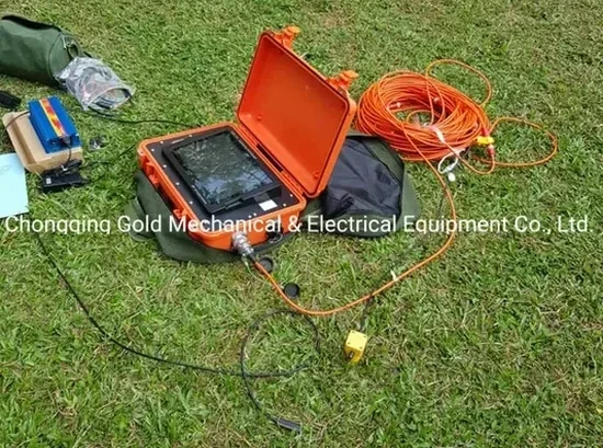
Field demonstration
Risks and considerations in Nottingham
Compare two jobs across town and the velocity models tell completely different stories. Over in West Bridgford, the Sherwood Sandstone sits close to the surface and seismic velocities run predictably high; you can design shallow pad footings with confidence after one refraction line. Head three miles east to the Colwick area, where the Mercia Mudstone weathers to a variable-grade clay, and the same survey picks up a low-velocity weathered zone that changes thickness by two metres in less than fifty metres of lateral distance. That kind of lateral heterogeneity is the difference between a straightforward build and a costly over-excavation. The risk is not that the ground is uniformly bad but that it is inconsistent, and seismic tomography is one of the few non-intrusive techniques that captures that variation across the full footprint of a proposed structure.
Our services
Our Nottingham seismic survey package covers the full workflow from field acquisition through tomographic inversion to interpreted engineering cross-sections. We tailor the method to the question: refraction for rippability and bedrock profiling, reflection for deeper structure.
Seismic refraction tomography
Ray-tracing inversion of first-break traveltimes to produce 2D velocity cross-sections. We use this routinely for mapping bedrock depth beneath the Sherwood Sandstone and identifying weathered zones in the Mercia Mudstone.
Seismic reflection profiling
Higher-energy acquisition with common-midpoint stacking for targets below 40 m. Applied in Nottingham for fault detection and deep stratigraphic mapping where the Triassic sequence dips beneath the Trent Valley.
Common questions
What depth can seismic refraction reach in Nottingham's geology?
With a 115-metre geophone spread and a weight-drop source, we typically image to 25–35 metres in the Sherwood Sandstone. Penetration drops in the Mercia Mudstone because the weathered zone attenuates seismic energy more quickly; there, useful refraction models rarely exceed 15–20 metres unless we switch to a larger source.
How much does a seismic refraction survey cost in Nottingham?
For a single refraction line of 24 geophones, budgets in the Nottingham area generally fall between £2,340 and £4,560, depending on line length, number of shot points, and access constraints. Reflection surveys with higher channel counts and a vibrator source run toward the upper end and beyond.
Can you run seismic lines on pavement or inside a warehouse?
Yes, we use spike-free geophone bases on hard surfaces and a drop-weight source that works on concrete slabs. The main constraint indoors is the clearance height for the weight-drop mechanism, but most industrial units in Nottingham's trading estates give us enough headroom.
How long does it take to get results?
Fieldwork for a single refraction spread is usually half a day. We deliver preliminary velocity cross-sections within three working days and the full interpreted report with engineering recommendations inside a week. More info.